Map Windows
|
The Map window is actually a series of informational maps that are accessible
through the City Info window. (You can get to the City Info window by selecting
City Info from the Windows menu.) Once you're in the City Info window, click
on the Map tab.You'll see a small representation of your game terrain. There
are a number of buttons above the mini-map that when clicked will let you
see a number of different map information displays.
Some of the map windows have additional radio button selections in the box
on the map's right to provide broader data. Click on them to bring up their
particulars. In maps that display information in shades of grey, the darker
the grey, the higher, heavier or denser the item being mapped.
If you select the Show in City Window checkbox while you are viewing a specific
map, only that particular selection, such as the power grid, will be viewable
in your main City window; all of the other city infrastructure will be erased
so you can focus on the extent or depth of your specific selection.
 Default Map View
City Services 
The City Services button controls four map displays. Click on any of the
radial buttons that let you choose between displaying fire department power,
fire department location, schools and colleges.
Fire Power shows the relative fire coverage of different parts of your city
in shades of grey. Fire Departments, Schools and Colleges show the locations
of these buildings as white squares.
Roads 
The Roads button controls three map views. Click on any of the radio buttons
that lets you choose between displaying roads, rails and traffic density.
Both Roads and Rails show those transportation pathways in your city. Traffic
shows the relative amount of traffic density in different parts of the city
in shades of grey.
Power Grid 
The Power Grid button activates a display of the power grid in your city.
Powered zones are shown in yellow, zones that have lost power are shown
in red, and power lines are shown in white.
Pollution 
The Pollution button activates a display of the relative amounts of pollution
in your city. This is a reading of all types of pollution combined, and
is shown in shades of grey.
Land Value 
The Land Value button activates a display of the relative property values
in the city, shown in shades of grey.
Crime 
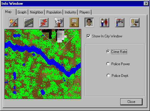 A Window on the Criminal World
The Crime button controls three map displays. Click on the available radio
buttons to choose between displaying Crime Rate, Police Power, and Police
Department location. Crime Rate shows the relative amount of crime in each
area of your city in shades of grey. Police Power shows the relative amount
of police coverage in different areas of the city, also in shades of grey.
Police Departments shows each of your stations as a white square.
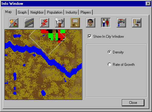
Population 
The Population button contains two map displays. Choose one of the radio
buttons to display either population density or the rate of population growth.
Population Density shows the relative number of Sims in each part of your
city in shades of grey. Rate of Growth shows where in the city the population
is increasing in shades of blue, and where it is decreasing in shades of
red. The darker the blue or red, the more drastic the population change.
Water System 
The Water System button activates a display of the water supply grid in
your city. Zones that are hooked to the water supply are shown in yellow,
zones that have no water are shown in red, and water pipes are shown in
white.
City Form 
The City Form button controls two map displays. Choose either the Structures
or Zones radial button.
Structures shows buildings and city infrastructure, including roads, rails,
etc. Zones shows the areas that have been zoned. Residential zones are shown
green, commercial zones are blue and industrial zones are yellow.
|
(C)1996, Maxis, Inc.
|